VRAIL Stage 29

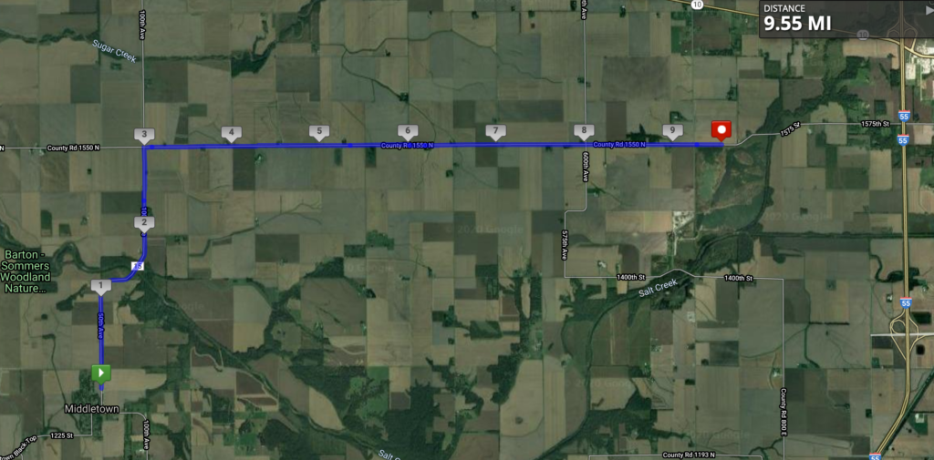
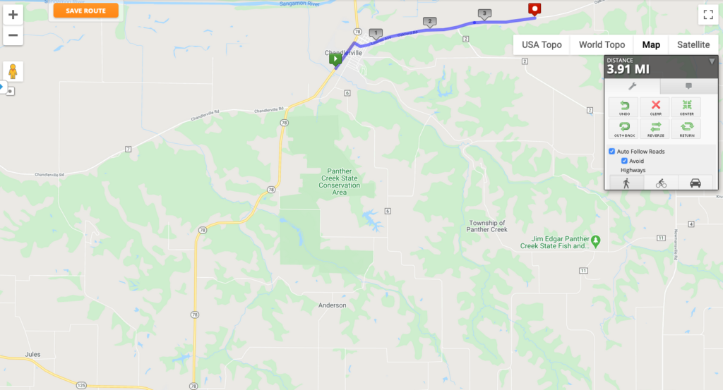
This stage marks an important milestone: after crossing over half of Illinois from west to east, this is the first time crossing an Interstate highway. I-55 runs from Chicago (just south of the city center) to I-10 west of New Orleans. Here, I’m crossing it just outside the city of Lincoln (more on this city later).

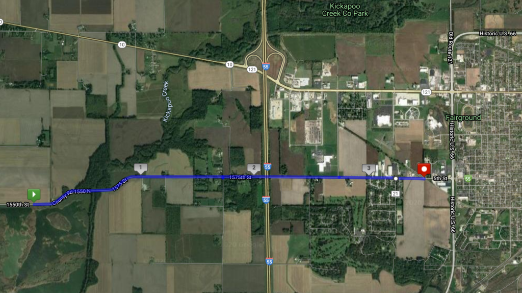
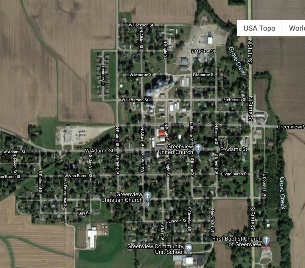
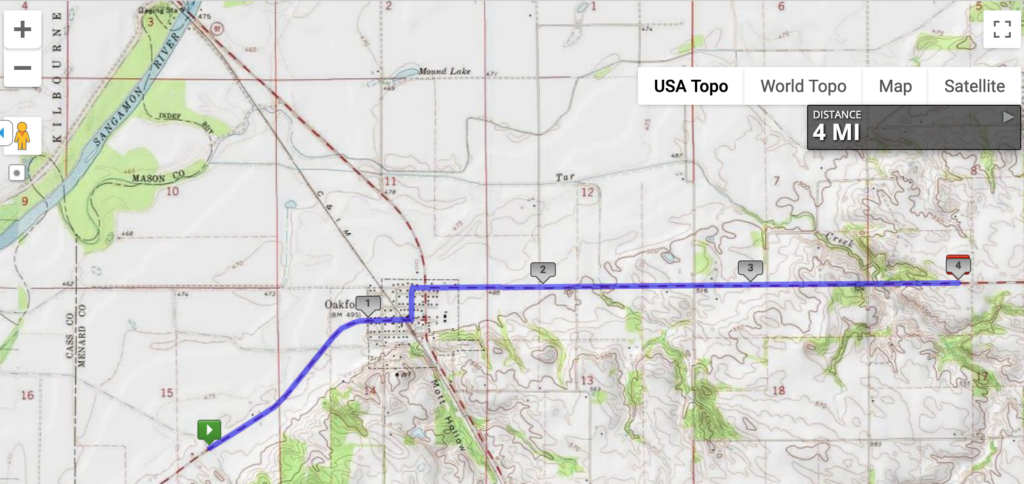
You’ll see on the map that today’s stage just stops short of Historic U.S. 66. Route 66 is probably the most famous U.S. Highway, formerly running from Chicago to L.A. before it was largely replaced by the U.S. Interstate system. This map actually shows quite well the multiple bypasses typical of even small towns along this route: the original city center, laid out along the railroad, was bypassed by the U.S. highway in the 1940s as long-distance road traffic began to increase in volume. Other land uses that require a lot of space and good access, such as the county fairgrounds, are often built along roads like these. Then in the 1950s/1960s, the Interstate was built at some greater distance from the city center, with a string of gas stations and fast-food restaurants connecting the exit to the built-up area. Lincoln has about 15,000 people, but it reflects the typical spatial development of a U.S. city along the interstate quite well.

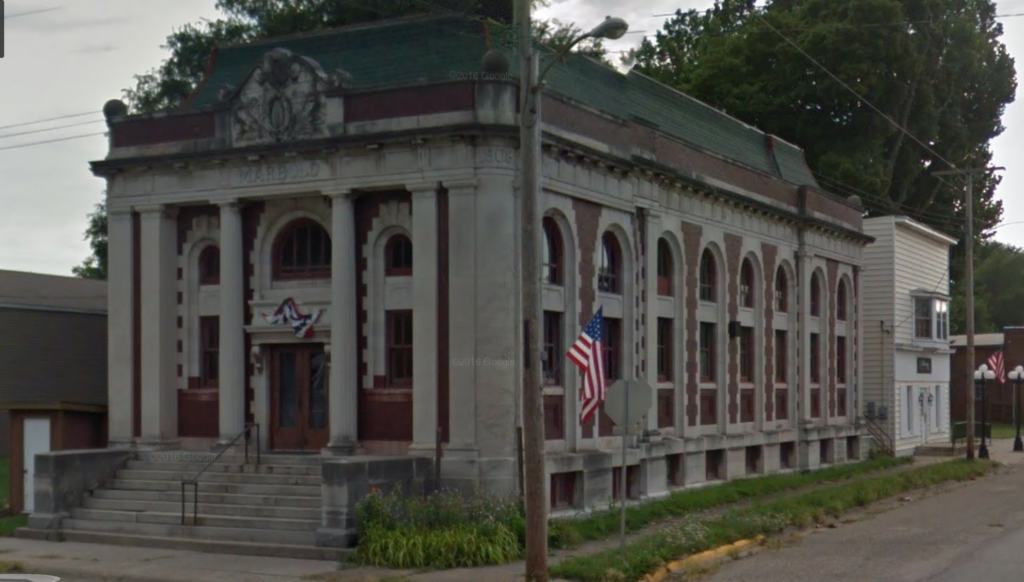
Today, Route 66 survives as a unique kind of tourist destination: one you have to drive to experience. Historic gas stations and diners exist all along its length, deliberately drawing on a 1950s-era nostalgia that works well to attract older tourists and Europeans, but is maybe less attractive to younger travelers.

VRAIL stages 26-28

Because I’m a bit behind, because my runs in the summer were short because of injury, and because there’s not much along the way, I’m combining three stages into one here. Leaving Middletown and approaching Lincoln:

I do like that just off the map in the northwest corner, Sugar Creek flows into Salt Creek. Note that there are multiple Sugar Creeks and Salt Creeks in Illinois, but I don’t know if there are any other salty-sweet confluences like this one. The only other thing to mention about this stage is that a few miles to the south of this map is a tiny town with the lovely name of Fancy Prairie. Other than that, this is the view!

VRAIL Stage 25

This stage puts me at the halfway point! Halfway across Illinois!

This 10K stage was along the Greenview Middletown Black Top road, leaving the town of Greenview before heading to, you guessed it, Middletown. I’m not sure what Middletown is in the middle of, but it was a stagecoach stop between Springfield and Peoria, so maybe that’s it. The obligatory “Abraham Lincoln was here” for this central Illinois location is that he surveyed the town back in the 1830s.

Middletown has a nice little post office, pictured below with the bonus of the Google Car reflected in the front window.

Middletown is also known for being a stop on the first coast-to-coast flight in the U.S. in 1911. The whole story is incredible, so I’m just going to quote it from Wikipedia:

The publisher William Randolph Hearst had offered a US$50,000 prize to the first aviator to fly coast to coast, in either direction, in less than 30 days from start to finish. Calbraith Perry Rodgers, grandnephew of naval hero Oliver Hazard Perry, and an avid yachtsman and motorcycle racer, had taken about 90 minutes of instruction from Orville Wright in June 1911 before soloing, and…became the first private citizen to buy a Wright airplane, a Wright Model B modified and called the Model EX. The plane’s 35 horsepower (26 kilowatt) engine allowed a speed of 50 miles per hour (80 km/hr) at 1000 feet (305 meters).

Since the airplane would need a considerable support crew, Rodgers persuaded J. Ogden Armour, of meatpacking fame, to sponsor the attempt, and in return named the plane after Armour’s new grape soft drink Vin Fiz. The support team rode on a three-car train called the Vin Fiz Special…The flight began at 4:30 pm, September 17, 1911, when Rodgers took off from the Sheepshead Bay Race Track in Brooklyn, New York. Although the plan called for a large number of stops along the way, in the end there were 75, including 16 crashes, and Rodgers was injured several times. Taylor and the team of mechanics rebuilt the Vin Fiz Flyer when necessary, and only a few pieces of the original plane actually made the entire trip.

On November 5, having missed the prize deadline by 19 days, Rodgers landed in Pasadena, California, in front of a crowd of 20,000. On the 12th he took off for Long Beach, California, but crashed at Compton, with a brain concussion and a spinal twist. He was hospitalized for three weeks. Finally, on December 10 he landed on the beach, and taxied the Flyer into the Pacific Ocean, completing the unprecedented journey of over 4,000 statute miles (6,400 km). Actual flying time totalled under 84 hours.

https://en.wikipedia.org/wiki/Vin_Fiz_Flyer (click for a map of the route, including Middletown)

I don’t know where to start. The 84 hours? The 16 crashes? The 90 minutes of instruction? The train support crew? The fact that the plane that arrived was not the same plane that took off? Sadly, Rodgers died shortly thereafter in a crash along the Pacific coast. But what a distinction for Middletown to be part of this trip!

VRAIL Stage 24

This stage was about three and a half miles, through the town of Greenview. I mentioned last time that the streets are named for the U.S. presidents, though not in order. It also appears that Adams is the main street, not Washington; I base this on the location of the village hall, as well as this beauty of a bank, built in 1908 and sadly empty:

VRAIL Stage 23

So it’s been a while. I have been having calf pain ever since my last half marathon in November, off and on. In early July, I was running kind of gingerly, but I stepped up onto a curb as I was also kind of moving to the side, and my calf went, “OWWWWW!” I rested, iced, stretched, and slowly started running again, but it kept hurting. Finally went to the sports clinic in town and was diagnosed as having a knot in my calf. That was it. Had some massage therapy in August, and I am finally back on track. It feels SO GOOD to be running again, even if it’s for short distances. I wasn’t keeping track in here because running was making me miserable, but now that things appear to be better, it’s time to catch up!

Stage 23 was almost to the little city of Greenview, climbing the arduous hill from the Sangamon River crossing, from about 516 feet above sea level to 541. Phew!

Greenview has an interesting set of street names: the Presidents out of order, with Douglas and Lincoln tucked in at the bottom. Interestingly, Adams and not Washington (the one between Jefferson and Adams) appears to be the main street…but more on that next time.

VRAIL Stage 22

Whee, I get to run down a (virtual) hill! This stage descends into the Sangamon River valley (the river is where the trees are in the distance) and just across the river. That’s a total of, um, 50 feet downhill. Based on news accounts, there seems to be a day or two every spring when this road is closed for flooding.

I found some references to this area and the last several stages as belonging to the “Pecan Bottoms” area of central Illinois. We usually associate pecans with the southern U.S., but they’re native in Illinois and Indiana in river bottoms. In fact, the botanical name of the pecan is Carya illinoinensis! The growing season is fairly short, so they don’t get very large in this part of North American, which is why commercial pecan production takes place farther south.

VRAIL Stage 21

This was a short stage; it’s been hot and humid lately, and I’m really missing being able to run indoors at the campus rec center. But this stage heads towards a crossing of the Sangamon River, here heading northward and unchannelized.

Continuing south past this point, you’d end up in Petersburg, the county seat and a little bit farther south, Lincoln’s New Salem. I have very vague memories of going there as a kid with my grandparents, but it’s the kind of place that most Illinois schoolchildren ended up going to at one point or another. New Salem was founded in 1829 as a milltown on the Sangamon, but as a previous post noted, the Sangamon was really hard to navigate with its sand bars and frequent flooding.

Lincoln only lived here for a few years, and by 1840, the village was abandoned after Petersburg was chosen as the county seat. Time passed, and Lincoln became more and more important as a one-time resident of this short-lived town. In 1906, William Randolph Hearst (yes, that William Randolph Hearst) bought the land the former village sat on and gave it to a private association who later transferred it to the state of Illinois. The village was reconstructed by the Civilian Conservation Corps during the Depression, and today it’s a big tourist attraction in central Illinois and a State Historic Site.

Image from IronBrigader.com of the store where Lincoln worked.

VRAIL Stage 20

This stage brings me up to 98.85 miles; almost a hundred miles under my belt this summer!

Today’s four miles involve the most serious altitude increase so far: 100 feet over 4 miles. (I know, right?) The topographic map below shows another kind of evidence for the unnatural form of the Sangamon River in the northwest corner: the county border between Menard and Mason Counties follows the original course of the Sangamon before it was channelized.

The town of Oakford with population 300 is on the Illinois & Midland Railroad, which carried coal from the southern Illinois coal fields to the Illinois River to be shipped by barge to coal-fired power plants around Chicago. Based on the pics below, they prefer simple names for their commercial establishments in Oakford. Also, I love the tiny false front on the Oakwood post office.

VRAIL Stage 18

I’ve been running but not posting, so I have some catching up to do!

Stage 18 passed through Chandlerville and turned off the main road to take a more direct route east. I neglected to note in the last stage that I was passing north of a settlement called Jules, which is my aunt’s nickname for me, so shoutout to Jules. 🙂

I could not find much to say about Chandlerville, except that it has an annual Burgoo. To my mind, that’s a Kentucky thing, but I’ve seen it argued that this part of Illinois is in the Upland South, so it makes sense. Burgoo is an event as much as a food: a huge pot of stew made with a wide variety of meats and vegetables, intended to feed a crowd. Here’s one recipe from Gun & Garden magazine. No one quite knows where the name came from, though it’s a good guess that it’s the Americanization of an original French term. Anyway, Chandlerville recently decided to cancel this summer’s Burgoo for the same reason pretty much everything is canceled this summer.

Chandlerville does still have a post office, but when the Google StreetView car drove through in 2013, literally the only establishment that was open in the two-block downtown was the post office. Here’s hoping things have gotten better for them since then.

VRAIL Stages 16 and 17

Combining stages again, one of 5K and one of 10K, since the scenery doesn’t change much along the way! These stages are along the very edge of the Sangamon River Valley, pretty clearly delineated in the terrain. Given the width of the floodplain, do you see anything…unusual about the Sangamon River?

Stages 16 and 17 along the floodplain’s edge. Super flat.

In a previous post, I talked about all of the drainage that had to be done to get this part of the state ready for agriculture, via tiles beneath the surface that direct water into ditches and rivers. As we can see from the Sangamon, even the rivers themselves were sometimes heavily modified to maximize the agricultural land available–and to make the rivers navigable. No other than Abe Lincoln (he had to appear at some point, this is central Illinois!) had a history of difficulties getting up and down the Sangamon from the state capital of Springfield to the Illinois River and parts south. In fact, he advocated channelizing the river to make it easier for boats to use (though that didn’t happen until 1949), and he even invented an inflatable device to help ships get unstuck from sand bars, based on his experience traveling on the Sangamon. More details can be found here.