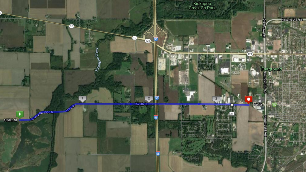
This stage marks an important milestone: after crossing over half of Illinois from west to east, this is the first time crossing an Interstate highway. I-55 runs from Chicago (just south of the city center) to I-10 west of New Orleans. Here, I’m crossing it just outside the city of Lincoln (more on this city later).
You’ll see on the map that today’s stage just stops short of Historic U.S. 66. Route 66 is probably the most famous U.S. Highway, formerly running from Chicago to L.A. before it was largely replaced by the U.S. Interstate system. This map actually shows quite well the multiple bypasses typical of even small towns along this route: the original city center, laid out along the railroad, was bypassed by the U.S. highway in the 1940s as long-distance road traffic began to increase in volume. Other land uses that require a lot of space and good access, such as the county fairgrounds, are often built along roads like these. Then in the 1950s/1960s, the Interstate was built at some greater distance from the city center, with a string of gas stations and fast-food restaurants connecting the exit to the built-up area. Lincoln has about 15,000 people, but it reflects the typical spatial development of a U.S. city along the interstate quite well.
Today, Route 66 survives as a unique kind of tourist destination: one you have to drive to experience. Historic gas stations and diners exist all along its length, deliberately drawing on a 1950s-era nostalgia that works well to attract older tourists and Europeans, but is maybe less attractive to younger travelers.
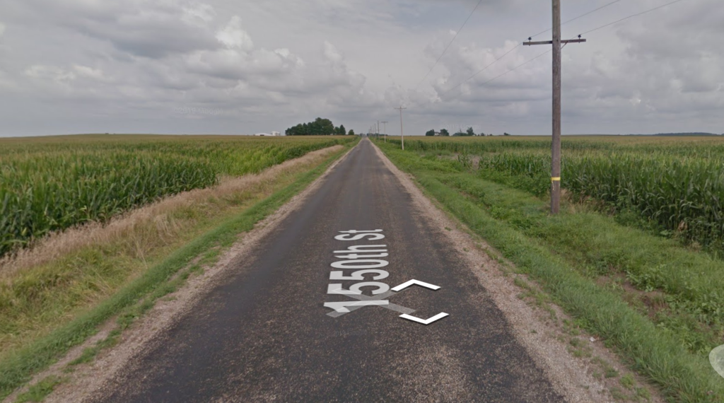
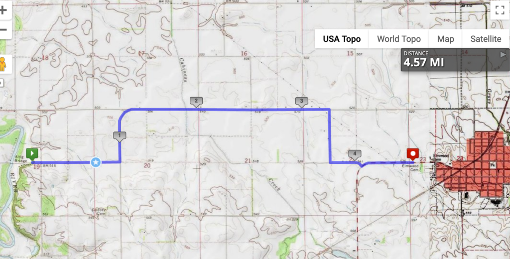
Because I’m a bit behind, because my runs in the summer were short because of injury, and because there’s not much along the way, I’m combining three stages into one here. Leaving Middletown and approaching Lincoln:
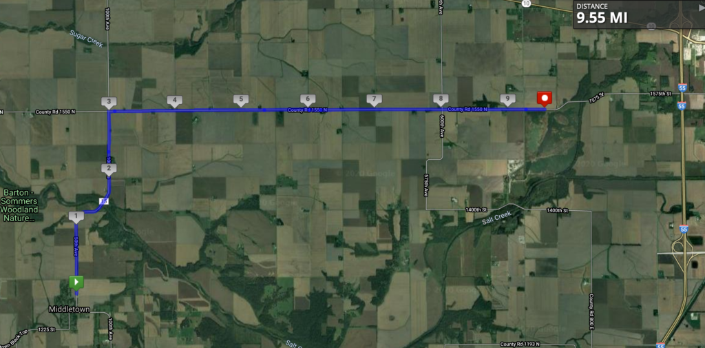
I do like that just off the map in the northwest corner, Sugar Creek flows into Salt Creek. Note that there are multiple Sugar Creeks and Salt Creeks in Illinois, but I don’t know if there are any other salty-sweet confluences like this one. The only other thing to mention about this stage is that a few miles to the south of this map is a tiny town with the lovely name of Fancy Prairie. Other than that, this is the view!
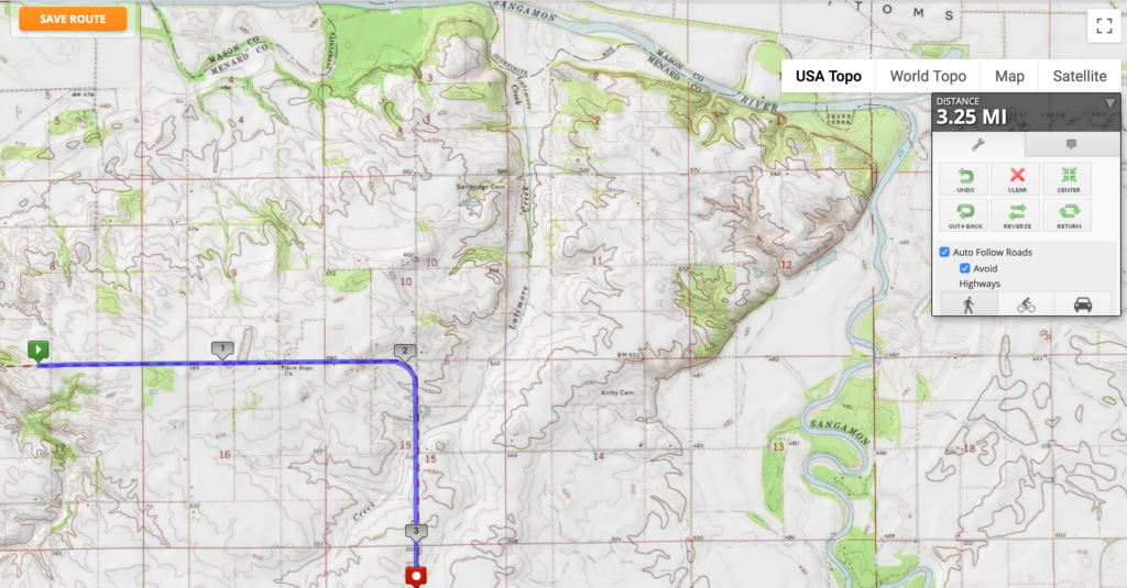
This stage puts me at the halfway point! Halfway across Illinois!
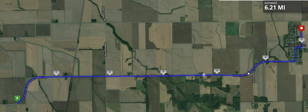
This 10K stage was along the Greenview Middletown Black Top road, leaving the town of Greenview before heading to, you guessed it, Middletown. I’m not sure what Middletown is in the middle of, but it was a stagecoach stop between Springfield and Peoria, so maybe that’s it. The obligatory “Abraham Lincoln was here” for this central Illinois location is that he surveyed the town back in the 1830s.
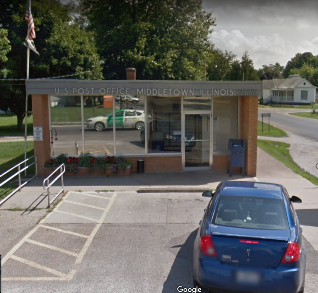
Middletown has a nice little post office, pictured below with the bonus of the Google Car reflected in the front window.
Middletown is also known for being a stop on the first coast-to-coast flight in the U.S. in 1911. The whole story is incredible, so I’m just going to quote it from Wikipedia:
The publisher William Randolph Hearst had offered a US$50,000 prize to the first aviator to fly coast to coast, in either direction, in less than 30 days from start to finish. Calbraith Perry Rodgers, grandnephew of naval hero Oliver Hazard Perry, and an avid yachtsman and motorcycle racer, had taken about 90 minutes of instruction from Orville Wright in June 1911 before soloing, and…became the first private citizen to buy a Wright airplane, a Wright Model B modified and called the Model EX. The plane’s 35 horsepower (26 kilowatt) engine allowed a speed of 50 miles per hour (80 km/hr) at 1000 feet (305 meters).
Since the airplane would need a considerable support crew, Rodgers persuaded J. Ogden Armour, of meatpacking fame, to sponsor the attempt, and in return named the plane after Armour’s new grape soft drink Vin Fiz. The support team rode on a three-car train called the Vin Fiz Special…The flight began at 4:30 pm, September 17, 1911, when Rodgers took off from the Sheepshead Bay Race Track in Brooklyn, New York. Although the plan called for a large number of stops along the way, in the end there were 75, including 16 crashes, and Rodgers was injured several times. Taylor and the team of mechanics rebuilt the Vin Fiz Flyer when necessary, and only a few pieces of the original plane actually made the entire trip.
On November 5, having missed the prize deadline by 19 days, Rodgers landed in Pasadena, California, in front of a crowd of 20,000. On the 12th he took off for Long Beach, California, but crashed at Compton, with a brain concussion and a spinal twist. He was hospitalized for three weeks. Finally, on December 10 he landed on the beach, and taxied the Flyer into the Pacific Ocean, completing the unprecedented journey of over 4,000 statute miles (6,400 km). Actual flying time totalled under 84 hours.
https://en.wikipedia.org/wiki/Vin_Fiz_Flyer (click for a map of the route, including Middletown)
I don’t know where to start. The 84 hours? The 16 crashes? The 90 minutes of instruction? The train support crew? The fact that the plane that arrived was not the same plane that took off? Sadly, Rodgers died shortly thereafter in a crash along the Pacific coast. But what a distinction for Middletown to be part of this trip!
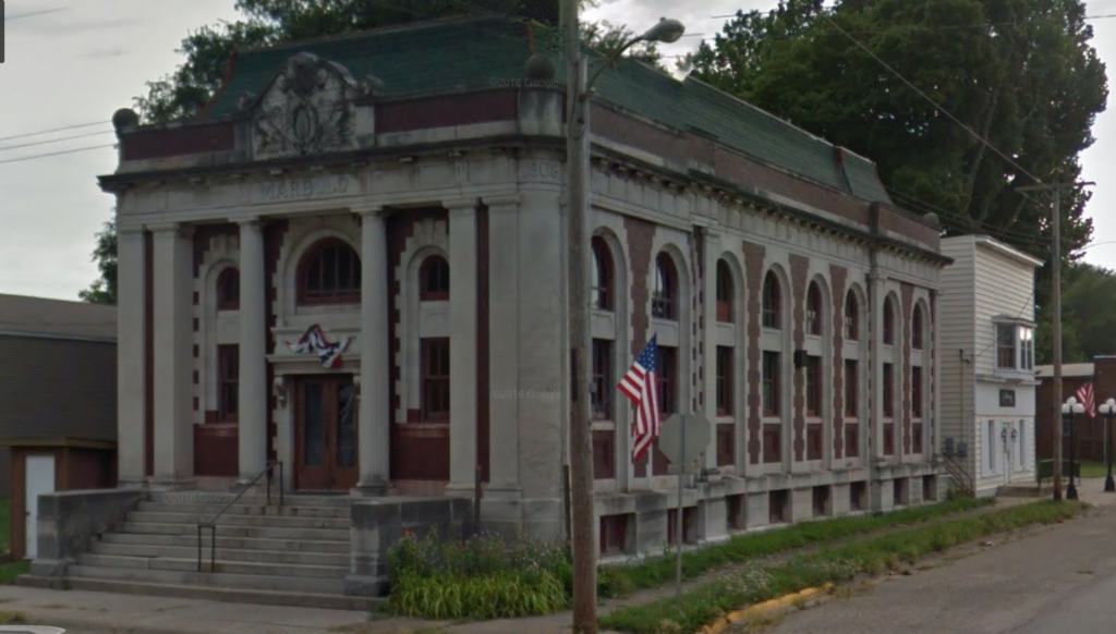
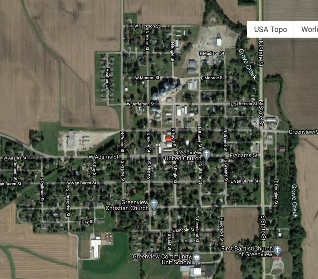
This stage was about three and a half miles, through the town of Greenview. I mentioned last time that the streets are named for the U.S. presidents, though not in order. It also appears that Adams is the main street, not Washington; I base this on the location of the village hall, as well as this beauty of a bank, built in 1908 and sadly empty:
I got this book because I saw Natchee Blu Barnd speak at the AAG in 2019 and was really interested in his work. I’m trying to read more about settler colonialism and geography, in part because of a course I’m teaching on U.S. regional geography, but also because I’m trying to read more by indigenous geographers. Given the full title–Native Space: Geographic Strategies to Unsettle Settler Colonialism–I thought it would be about strategies within the discipline of geography. Instead, it was about the geographic strategies that indigenous people use to resist, which was just as interesting.
From Oregon State University Press
I love geography studies that focus on the mundane, taken-for-granted aspects of life that nevertheless have a strong place/space component. In this case, that includes street signs, license plates, and hometown parades. Brand’s detailed analysis of the communities across the U.S. with Native American-themed street names, both in and outside of reservation spaces, does a nice job of showing the value of looking at something so quotidian with a fine parsing of meaning and implications. There’s also an interesting chapter on Satanta, KS, and the descendants of Set-Tainte, for whom the town is named, that gets at some of the complexities of a White town trying to honor Native Americans while the Kiowa people try to honor their ancestor.
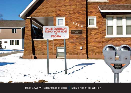
Brand then switches to looking at indigenous artists who use maps and other geographical elements in their work, first in a chapter on prints and paintings, and then in a chapter in installation art. I was glad to see Edgar Heap of Birds discussed here, because he had an installation on my campus in Urbana-Champaign for a while that was incredibly thought-provoking (see below). One of the things I’m learning from reading more books influenced by Ethnic Studies (Genevieve Carpio’s Collision at the Crossroads, Eric Avila’s The Folklore of the Freeway) is the importance of considering artists’ work alongside what social scientists might consider as more traditional academic subject matter.
I really enjoyed this book. I would definitely consider using it in my undergrad class because it’s a perfect combination of how we can look at seemingly minor aspects of the landscape like street signs–something students can do no matter where they are–and then use those elements of the landscape to understand how settler colonialism is an ongoing process that can still be “unsettled” and resisted. At the same time, and most valuable from a theoretical perspective, Brand illustrates in a number of ways how White and Native spaces overlap each other on the same territory, and that this overlap itself is a different kind of spatiality: “Contemporary Native space continues to defy the spatial absoluteness, certainty, and singularity that colonization intends to generate. Native space maintains layered geographies, and provides for coexisting partialities” (p. 97). Getting students to understand these simultaneous ways of seeing space would be a worthy goal in and of itself.
So it’s been a while. I have been having calf pain ever since my last half marathon in November, off and on. In early July, I was running kind of gingerly, but I stepped up onto a curb as I was also kind of moving to the side, and my calf went, “OWWWWW!” I rested, iced, stretched, and slowly started running again, but it kept hurting. Finally went to the sports clinic in town and was diagnosed as having a knot in my calf. That was it. Had some massage therapy in August, and I am finally back on track. It feels SO GOOD to be running again, even if it’s for short distances. I wasn’t keeping track in here because running was making me miserable, but now that things appear to be better, it’s time to catch up!
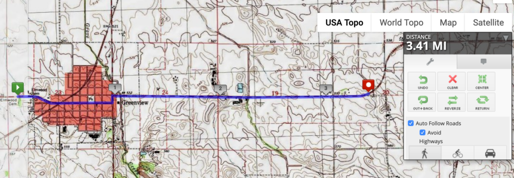
Stage 23 was almost to the little city of Greenview, climbing the arduous hill from the Sangamon River crossing, from about 516 feet above sea level to 541. Phew!
Greenview has an interesting set of street names: the Presidents out of order, with Douglas and Lincoln tucked in at the bottom. Interestingly, Adams and not Washington (the one between Jefferson and Adams) appears to be the main street…but more on that next time.
So I bought Nina Sylvanus’s Patterns in Circulation: Cloth, Gender, and Materiality in West Africa because I’m a quilter and am interested in fabric. I know very little about West Africa and its position in global circuits of trade, or about the wax cloth representative of this region. But man, was this book interesting. It was so well put-together in terms of separate topics in separate chapters that all tie in to a main theme, and in attending to both global capital and local culture, nationalism and livelihoods, symbolic meaning and (literally) materiality, individual women’s stories and anthropological theory. I would definitely recommend it if you’re interested in gender and development, post-colonial Africa, and/or cultural economic geography.
Part of why this book is so rich is that it’s based on over thirty months of fieldwork spread out over a decade. That’s what enables Sylvanus to get at the multiple meanings of pagne, the wax-dyed cloth that is so important economically, socially, and culturally in Togo and other parts of West Africa. On the one hand, she’s taking a commodity and tracing it through its colonial origins in the Dutch East Indies, its postcolonial role in connecting female traders to Togo’s dictator, and the post-postcolonial neoliberal regime that creates new entrepreneurial subjects focused on making individual connections to Chinese factories. In the process, Sylvanus argues that West Africa has been “global” for centuries, and not only as a site of resource extraction: Dutch clothmakers had to learn to pay attention to the styles and preferences of African consumers in order to produce a successful product.
Si tu sors, je sors (if you go out, I go out), is worn to indicate to your spouse that you know he’s been seeing someone on the side, and so now you have license to do the same.
At the same time, this book is an anthropological study of the different patterns of pagne in terms of how the designs communicate meaning to others (see above). There’s also the matter of how women wear this cloth to public events in deliberately performative ways to evoke status, ambition, and identity. The pattern, how the clothing is shaped, and how it’s accessorized are all key. More recently, knockoff versions of traditional clothing create a whole new level of complexity, as bystanders evaluate not just the pattern, but how high quality an imitation it is. It’s not just a matter of sight: it’s also how the cloth feels on the skin and drapes on the body, something that has to be personally experienced.
This design I found on Pinterest is a good example of the skilled tailoring required to use the pattern of the pagne in just the right way, centering the starburst design so that it also expands into the double-ruffled shoulders.
The last chapter talks about China-in-Africa, contrasting the literature on neo-colonialism and paternalistic Western concerns about infrastructure investment with a ground-up view as to how Togolese women are themselves drawing Chinese investment into Africa. In particular, they are making regular journeys to Guangzhou and Yiwu to supervise their own textile production, as structural adjustment and currency devaluation have made Dutch fabrics too expensive, and WTO agreements have decimated African textile production. At the same time, the Togolese government is under pressure to develop the center of Lomé in a fashion more conducive to international investment than the traditional cloth market that has been a fundamental part of the country’s identity, threatening the livelihood of these women on another front.
Overall, Sylvanus does an excellent job of bringing together multiple scales and registers of analysis. I learned a lot about cloth as an aspect of West Africa that doesn’t get much attention in the literature–perhaps because it is economically and culturally dominated by women, and I would definitely recommend it.
Katherine McKittrick famously wrote that “Black matters are spatial matters” in Demonic Grounds, and Brandi Summers demonstrates that in two interconnected ways in Black in Place: how blackness is employed in placemaking while Black bodies are removed from that same place. These simultaneous processes drive the production of space in the process of gentrifying H Street in Washington, DC. I really enjoyed this book and got a lot out it; I would highly recommend it for urban scholars of any background.
University of North Carolina Press.
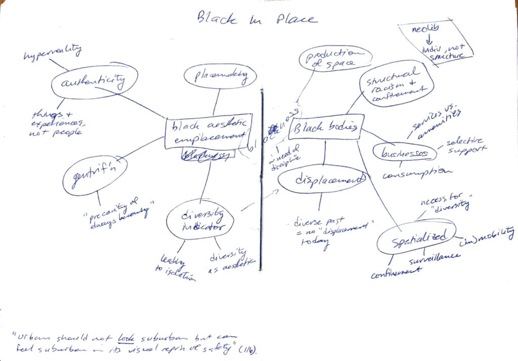
Summers’s book was an interesting companion to David Wilson’s book on Chicago that I read earlier this year. Wilson looked at blues clubs and the tension between their role as community centers and their growing importance as tourist attractions, with gentrification looming on the horizon. Summers addresses a very similar concept in the case of H Street, but she develops an analytical tool to understand it: black aesthetic emplacement. Redeveloping H Street means keeping just enough of its African American heritage visible to make it “cool” and “diverse” and a little bit edgy, while brushing aside the lived history and current inhabitants of this place. She points out the importance of “authenticity” and notes that it’s usually attached to things and experiences, but not people. So a neighborhood is “authentic” if its built environment evokes a certain kind of past, or if newcomers can eat certain ethnic foods, but interacting with the people who produced that built environment is not important.
Black aesthetic emplacement for Summers functions as a kind of diversity indicator, because diversity itself is an aesthetic. Diversity is on the surface, appearing to take in all comers in a harmonious whole, but it ignores the histories and social processes underlying the presence of different groups and what they’re allowed to do in that space. On H Street, Summers argues that Irish and Jewish pasts were unearthed and put on display to demonstrate that this had not always been a Black neighborhood, but that African Americans were just one of many groups who had lived here over the years. That makes it okay for white gentrifiers to move in as just the latest group to inhabit an ever-changing, always-diverse space.
The flip side of black aesthetic emplacement is Black displacement. Actual Black people don’t drive up property values and increase the coolness factor the same way that a black aesthetic does. So as H Street has been redeveloped for white suburbanites to move back into the city, that process has pushed out existing residents not just through higher rents, but through the elimination of the businesses that had managed to remain through decades of disinvestment. Summers shows how city programs to develop small businesses explicitly exclude Black-owned businesses like hair salons and convenience stores in favor of “innovative” shops like Pilates studios and dog boutiques. Unlike my vague, passive voice above about “being redeveloped,” Summers therefore identifies the specific mechanisms by which commercial gentrification occurs.
What I was most interested in, of course, was the relationship to mobility. While the H Street streetcar isn’t a main focus of the book, Summers does discuss the ways in which formal and informal surveillance work to police Black mobilities along H Street. “Diversity” still benefits from the presence of some Black people, but not too many, and only if they’re in motion on the bus rather than socializing on the sidewalk. This comes back around to the aesthetics argument in my favorite line from the book: “Urban should not look suburban but can feel suburban in its visual representation of safety” (p. 116). As a white child of the suburbs who grew up afraid of cities and who acknowledges that even today, I’m only comfortable in some kinds of urban neighborhoods, this really hit home. Actually, the whole book made me think a lot about my past and present relationship to cities, above and beyond its excellent critique of specific elements of gentrification and placemaking.
Below is a scan of my mind map of the book, if that might be of interest. I try to do this for most books that I read, either chapter by chapter or for the whole book. (The line down the middle is just the center of the hand-bound book.)
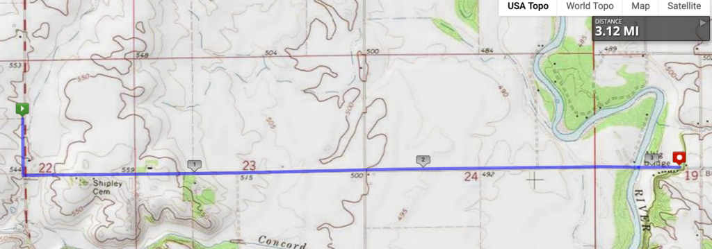
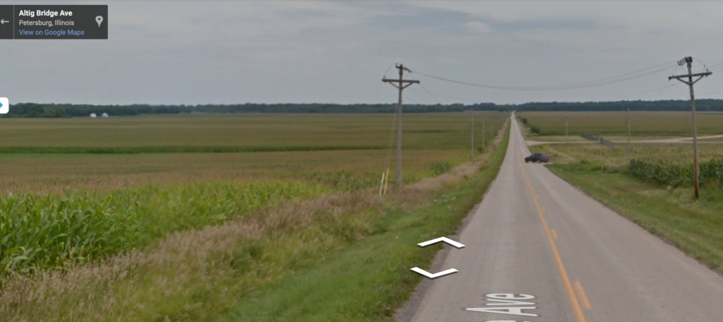
Whee, I get to run down a (virtual) hill! This stage descends into the Sangamon River valley (the river is where the trees are in the distance) and just across the river. That’s a total of, um, 50 feet downhill. Based on news accounts, there seems to be a day or two every spring when this road is closed for flooding.
I found some references to this area and the last several stages as belonging to the “Pecan Bottoms” area of central Illinois. We usually associate pecans with the southern U.S., but they’re native in Illinois and Indiana in river bottoms. In fact, the botanical name of the pecan is Carya illinoinensis! The growing season is fairly short, so they don’t get very large in this part of North American, which is why commercial pecan production takes place farther south.
This was a short stage; it’s been hot and humid lately, and I’m really missing being able to run indoors at the campus rec center. But this stage heads towards a crossing of the Sangamon River, here heading northward and unchannelized.
Continuing south past this point, you’d end up in Petersburg, the county seat and a little bit farther south, Lincoln’s New Salem. I have very vague memories of going there as a kid with my grandparents, but it’s the kind of place that most Illinois schoolchildren ended up going to at one point or another. New Salem was founded in 1829 as a milltown on the Sangamon, but as a previous post noted, the Sangamon was really hard to navigate with its sand bars and frequent flooding.
Lincoln only lived here for a few years, and by 1840, the village was abandoned after Petersburg was chosen as the county seat. Time passed, and Lincoln became more and more important as a one-time resident of this short-lived town. In 1906, William Randolph Hearst (yes, that William Randolph Hearst) bought the land the former village sat on and gave it to a private association who later transferred it to the state of Illinois. The village was reconstructed by the Civilian Conservation Corps during the Depression, and today it’s a big tourist attraction in central Illinois and a State Historic Site.
Image from IronBrigader.com of the store where Lincoln worked.