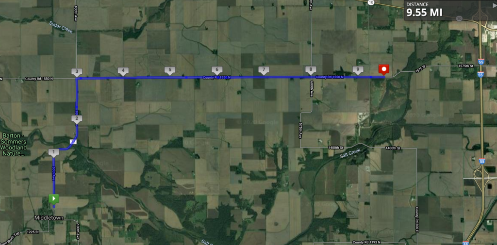
Because I’m a bit behind, because my runs in the summer were short because of injury, and because there’s not much along the way, I’m combining three stages into one here. Leaving Middletown and approaching Lincoln:
I do like that just off the map in the northwest corner, Sugar Creek flows into Salt Creek. Note that there are multiple Sugar Creeks and Salt Creeks in Illinois, but I don’t know if there are any other salty-sweet confluences like this one. The only other thing to mention about this stage is that a few miles to the south of this map is a tiny town with the lovely name of Fancy Prairie. Other than that, this is the view!
This stage puts me at the halfway point! Halfway across Illinois!
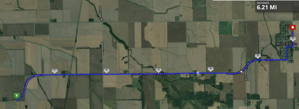
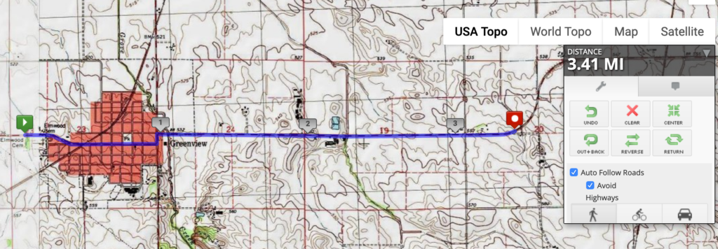
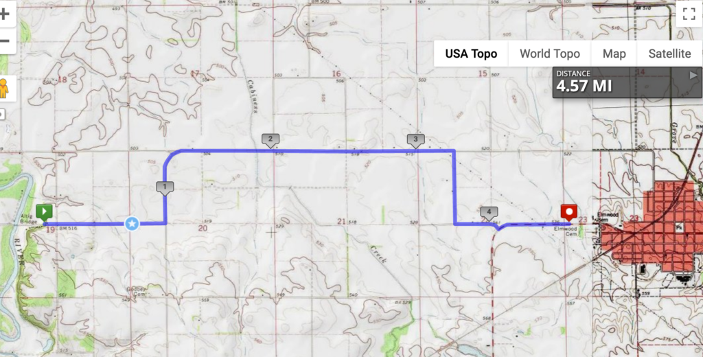
This 10K stage was along the Greenview Middletown Black Top road, leaving the town of Greenview before heading to, you guessed it, Middletown. I’m not sure what Middletown is in the middle of, but it was a stagecoach stop between Springfield and Peoria, so maybe that’s it. The obligatory “Abraham Lincoln was here” for this central Illinois location is that he surveyed the town back in the 1830s.
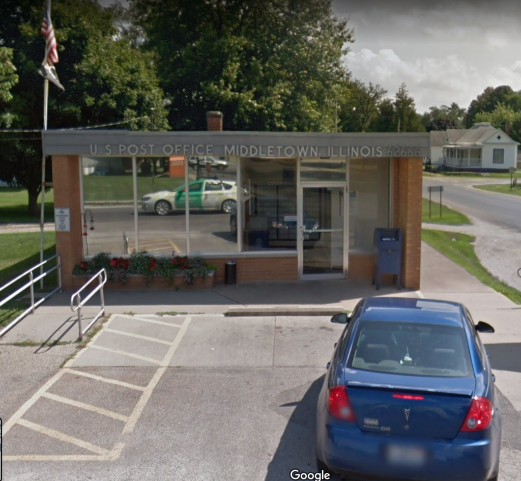
Middletown has a nice little post office, pictured below with the bonus of the Google Car reflected in the front window.
Middletown is also known for being a stop on the first coast-to-coast flight in the U.S. in 1911. The whole story is incredible, so I’m just going to quote it from Wikipedia:
The publisher William Randolph Hearst had offered a US$50,000 prize to the first aviator to fly coast to coast, in either direction, in less than 30 days from start to finish. Calbraith Perry Rodgers, grandnephew of naval hero Oliver Hazard Perry, and an avid yachtsman and motorcycle racer, had taken about 90 minutes of instruction from Orville Wright in June 1911 before soloing, and…became the first private citizen to buy a Wright airplane, a Wright Model B modified and called the Model EX. The plane’s 35 horsepower (26 kilowatt) engine allowed a speed of 50 miles per hour (80 km/hr) at 1000 feet (305 meters).
Since the airplane would need a considerable support crew, Rodgers persuaded J. Ogden Armour, of meatpacking fame, to sponsor the attempt, and in return named the plane after Armour’s new grape soft drink Vin Fiz. The support team rode on a three-car train called the Vin Fiz Special…The flight began at 4:30 pm, September 17, 1911, when Rodgers took off from the Sheepshead Bay Race Track in Brooklyn, New York. Although the plan called for a large number of stops along the way, in the end there were 75, including 16 crashes, and Rodgers was injured several times. Taylor and the team of mechanics rebuilt the Vin Fiz Flyer when necessary, and only a few pieces of the original plane actually made the entire trip.
On November 5, having missed the prize deadline by 19 days, Rodgers landed in Pasadena, California, in front of a crowd of 20,000. On the 12th he took off for Long Beach, California, but crashed at Compton, with a brain concussion and a spinal twist. He was hospitalized for three weeks. Finally, on December 10 he landed on the beach, and taxied the Flyer into the Pacific Ocean, completing the unprecedented journey of over 4,000 statute miles (6,400 km). Actual flying time totalled under 84 hours.
https://en.wikipedia.org/wiki/Vin_Fiz_Flyer (click for a map of the route, including Middletown)
I don’t know where to start. The 84 hours? The 16 crashes? The 90 minutes of instruction? The train support crew? The fact that the plane that arrived was not the same plane that took off? Sadly, Rodgers died shortly thereafter in a crash along the Pacific coast. But what a distinction for Middletown to be part of this trip!
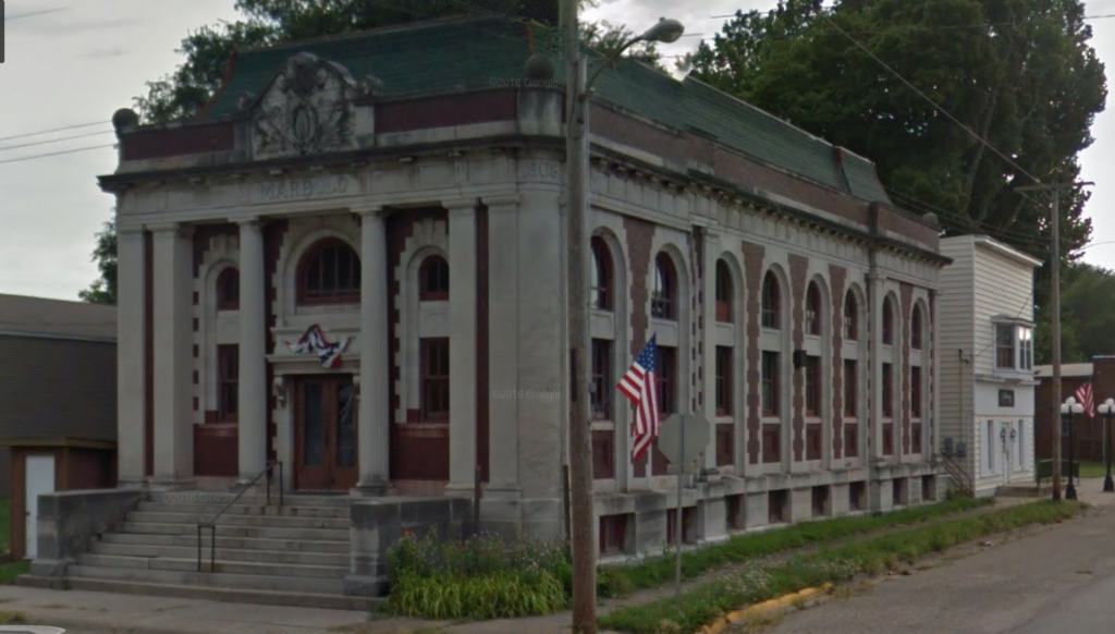
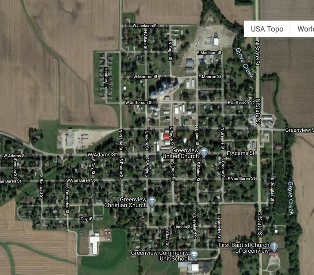
This stage was about three and a half miles, through the town of Greenview. I mentioned last time that the streets are named for the U.S. presidents, though not in order. It also appears that Adams is the main street, not Washington; I base this on the location of the village hall, as well as this beauty of a bank, built in 1908 and sadly empty:
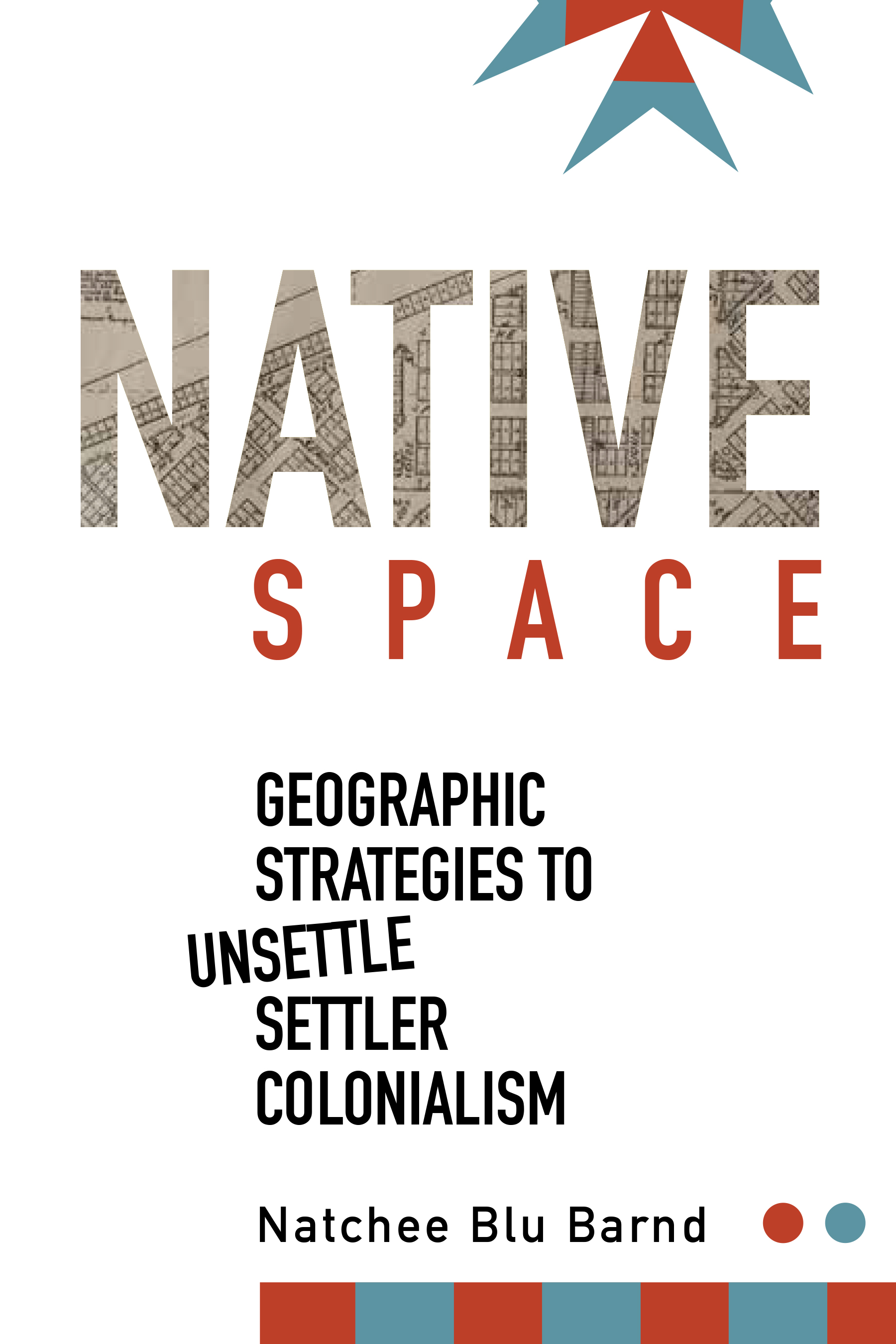
I got this book because I saw Natchee Blu Barnd speak at the AAG in 2019 and was really interested in his work. I’m trying to read more about settler colonialism and geography, in part because of a course I’m teaching on U.S. regional geography, but also because I’m trying to read more by indigenous geographers. Given the full title–Native Space: Geographic Strategies to Unsettle Settler Colonialism–I thought it would be about strategies within the discipline of geography. Instead, it was about the geographic strategies that indigenous people use to resist, which was just as interesting.
From Oregon State University Press
I love geography studies that focus on the mundane, taken-for-granted aspects of life that nevertheless have a strong place/space component. In this case, that includes street signs, license plates, and hometown parades. Brand’s detailed analysis of the communities across the U.S. with Native American-themed street names, both in and outside of reservation spaces, does a nice job of showing the value of looking at something so quotidian with a fine parsing of meaning and implications. There’s also an interesting chapter on Satanta, KS, and the descendants of Set-Tainte, for whom the town is named, that gets at some of the complexities of a White town trying to honor Native Americans while the Kiowa people try to honor their ancestor.
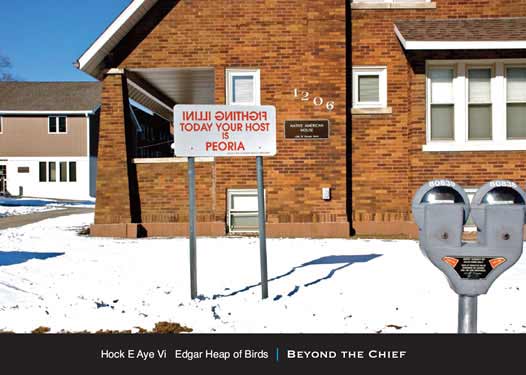
Brand then switches to looking at indigenous artists who use maps and other geographical elements in their work, first in a chapter on prints and paintings, and then in a chapter in installation art. I was glad to see Edgar Heap of Birds discussed here, because he had an installation on my campus in Urbana-Champaign for a while that was incredibly thought-provoking (see below). One of the things I’m learning from reading more books influenced by Ethnic Studies (Genevieve Carpio’s Collision at the Crossroads, Eric Avila’s The Folklore of the Freeway) is the importance of considering artists’ work alongside what social scientists might consider as more traditional academic subject matter.
I really enjoyed this book. I would definitely consider using it in my undergrad class because it’s a perfect combination of how we can look at seemingly minor aspects of the landscape like street signs–something students can do no matter where they are–and then use those elements of the landscape to understand how settler colonialism is an ongoing process that can still be “unsettled” and resisted. At the same time, and most valuable from a theoretical perspective, Brand illustrates in a number of ways how White and Native spaces overlap each other on the same territory, and that this overlap itself is a different kind of spatiality: “Contemporary Native space continues to defy the spatial absoluteness, certainty, and singularity that colonization intends to generate. Native space maintains layered geographies, and provides for coexisting partialities” (p. 97). Getting students to understand these simultaneous ways of seeing space would be a worthy goal in and of itself.
So it’s been a while. I have been having calf pain ever since my last half marathon in November, off and on. In early July, I was running kind of gingerly, but I stepped up onto a curb as I was also kind of moving to the side, and my calf went, “OWWWWW!” I rested, iced, stretched, and slowly started running again, but it kept hurting. Finally went to the sports clinic in town and was diagnosed as having a knot in my calf. That was it. Had some massage therapy in August, and I am finally back on track. It feels SO GOOD to be running again, even if it’s for short distances. I wasn’t keeping track in here because running was making me miserable, but now that things appear to be better, it’s time to catch up!
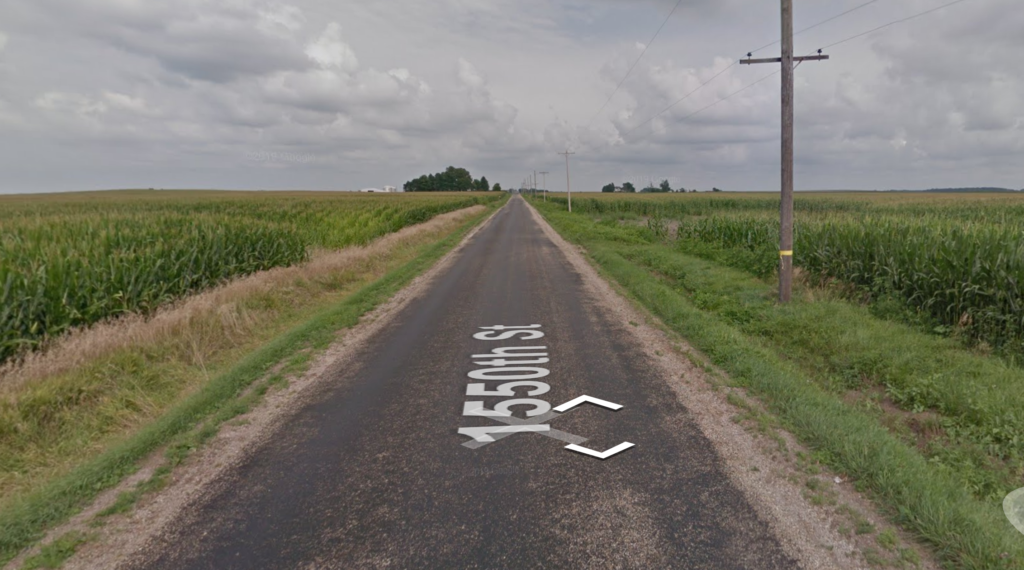
Stage 23 was almost to the little city of Greenview, climbing the arduous hill from the Sangamon River crossing, from about 516 feet above sea level to 541. Phew!
Greenview has an interesting set of street names: the Presidents out of order, with Douglas and Lincoln tucked in at the bottom. Interestingly, Adams and not Washington (the one between Jefferson and Adams) appears to be the main street…but more on that next time.